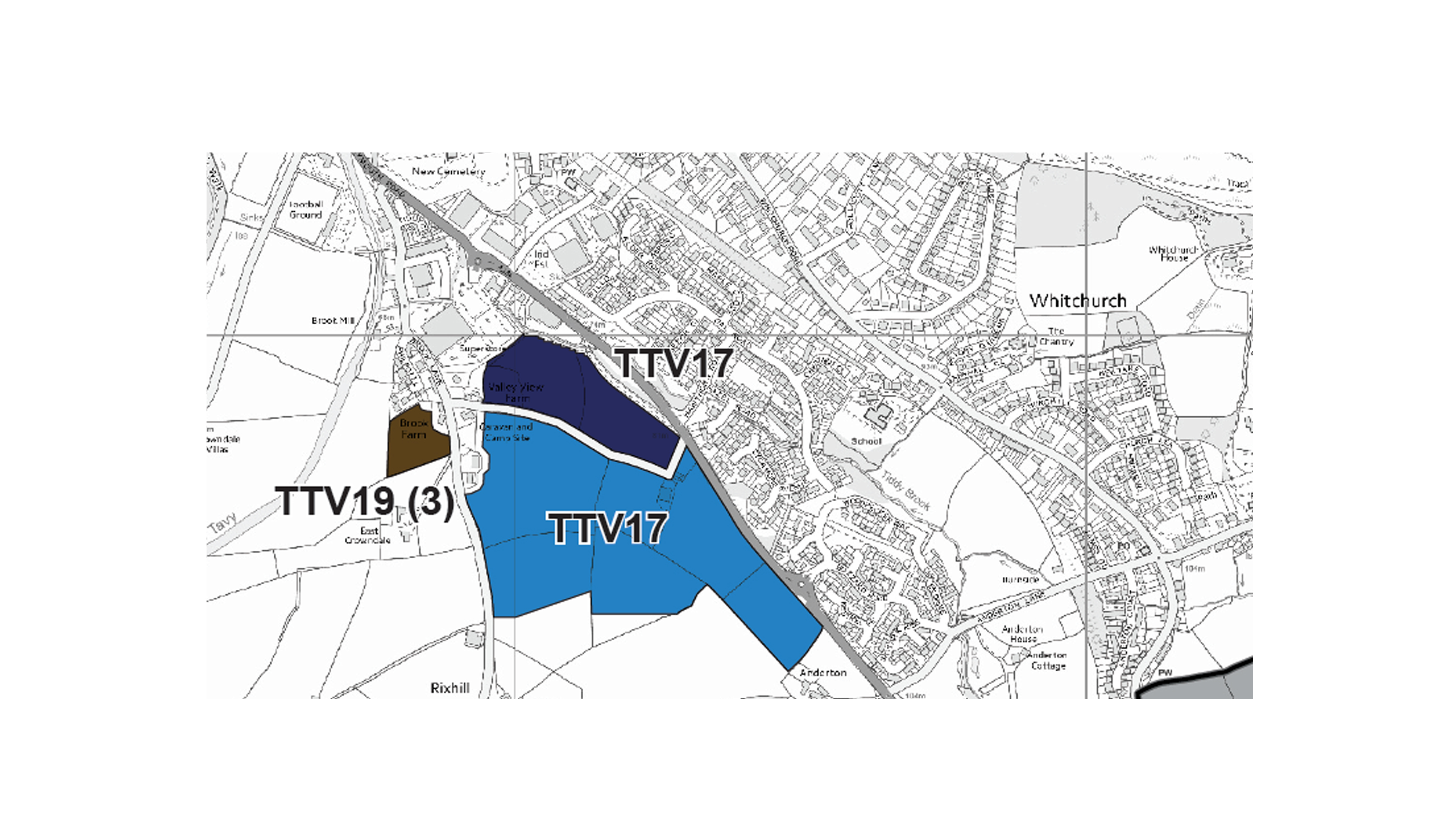
TTV17 - Plymouth Road, Tavistock
The Plymouth and South West Devon Joint Local Plan has now been adopted! To find out more please visit the Plymouth and South West Devon Joint Local Plan: Adoption page.
Visit the interactive Plymouth Plan to see other policies that affect decision making across Plymouth City including the Council and its partners.
Land at Plymouth Road is allocated for a mixed-use development. Provision is made for in the order of 300 new homes and 18,600 sq.m. of employment (Use Class B1). Development should provide for the following:
- A strategic landscaping buffer along the west of the site, to be informed by a Landscape and Visual Assessment, in order to address the site’s scale and prominence, to help mitigate any adverse visual impact on the AONB, and to soften the edges of the development onto the undeveloped countryside. The scale, density materials, design and southern extents of development should ensure that it is not overly prominent when viewed from the town and surrounding countryside
- High quality design including positive frontages onto the adjoining road network, especially the main road, marking the arrival into the town from the south east.
- Provision of suitable access arrangements, including exploring opportunities for a second access to help local traffic flow.
- Contributions towards the re-instatement of the railway line.
- The retention of the Public Right of Way which runs across the site to provide access to the wider countryside and to the National Cycle Network.
- A lighting strategy, which minimises the impact of light spill to the surrounding countryside.